What's new in TryTool
Every release, newest first. Only changes you can actually see and use are listed here.
0.5.6
LatestTraffic cameras, congestion for the whole country, and a satellite view.
Traffic
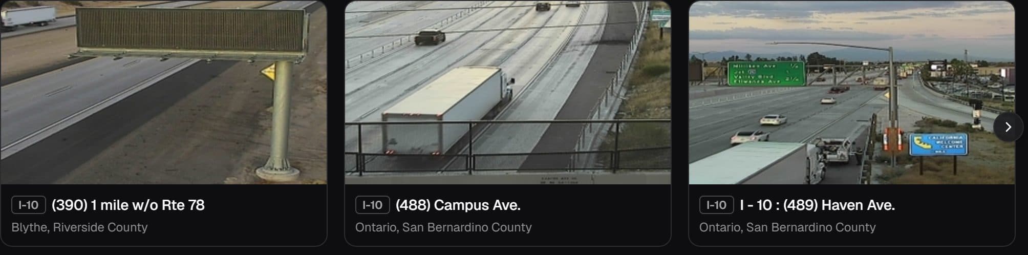
- A new Traffic page. Around 4,600 public street cameras from California and Iowa on one map. Some carry live video; the rest publish a still picture that refreshes about once a minute.
- Congestion everywhere, not only where the cameras are. The green, amber and red flow lines cover all fifty states. Two states publish cameras; every state has traffic.
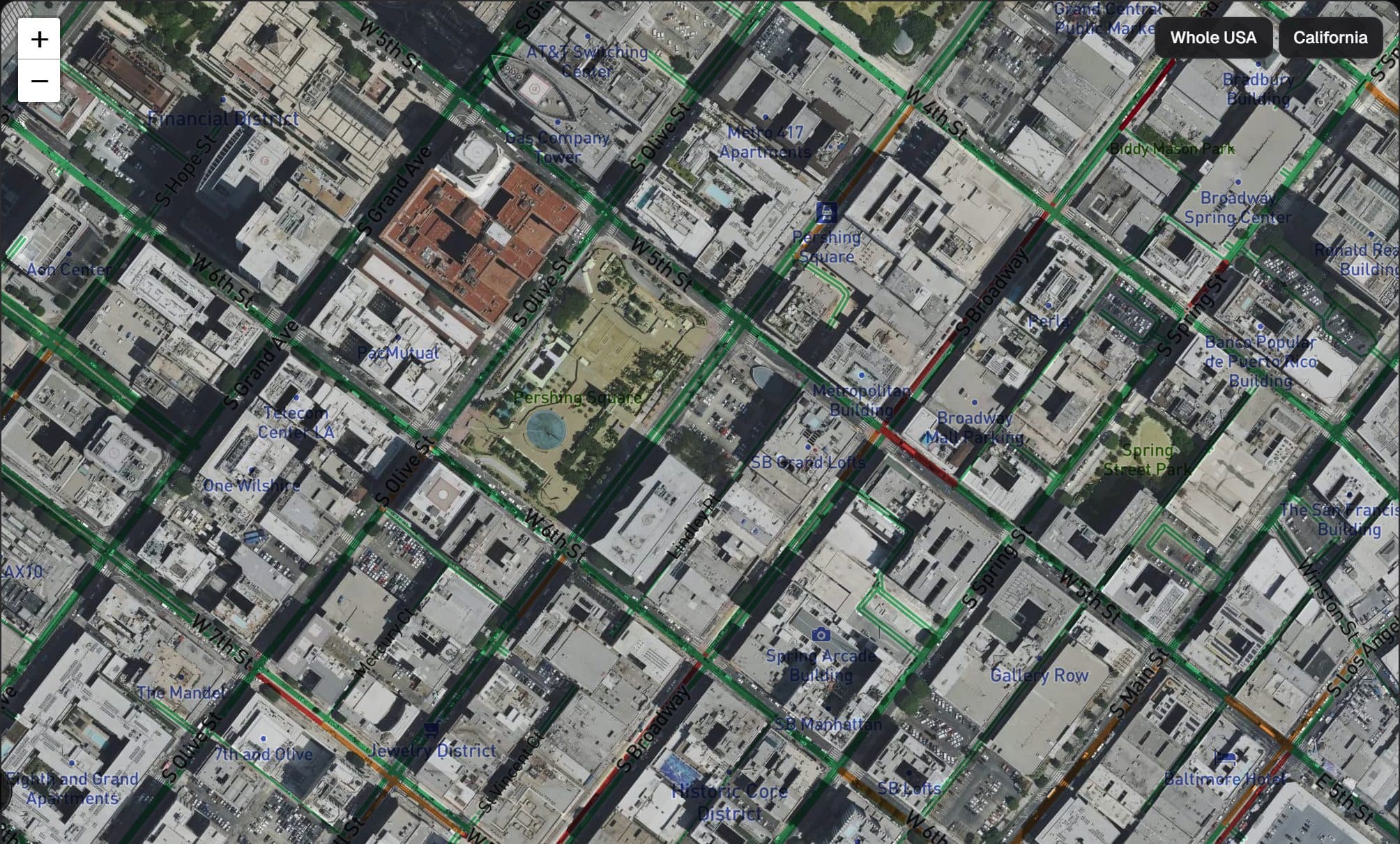
- A satellite view. Photographic imagery instead of the drawn map, and it can be switched on at the same time as congestion, so the flow lines sit on the road you are actually looking at. One thing worth being plain about: the imagery is aerial photography, not a live picture from space. What is live is the traffic drawn over it.
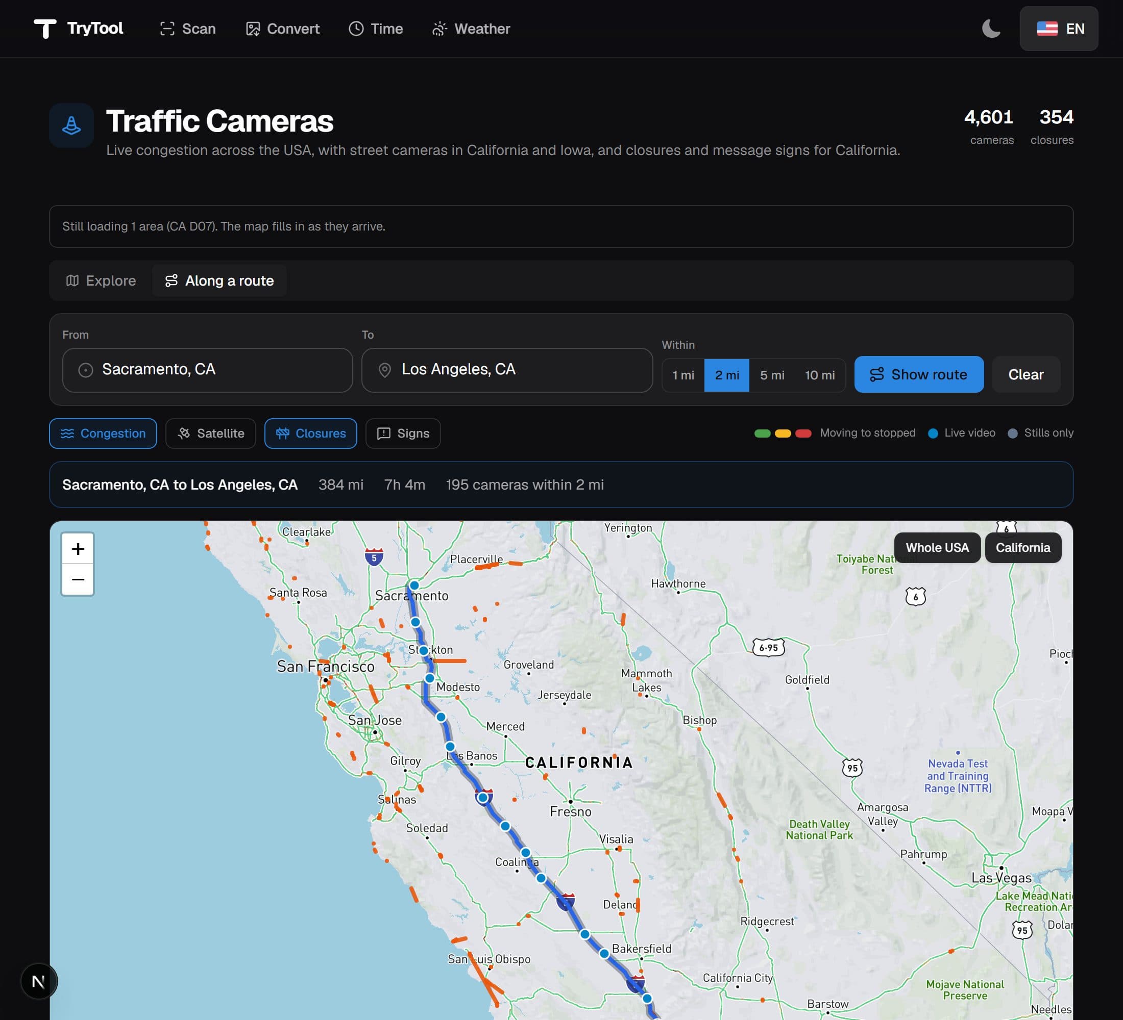
- The cameras along a drive. Give it a start and a destination and it lists the cameras you would pass, in the order you would pass them, with how far into the trip each one sits.
- Search anywhere in the country. Searching for a place with no cameras used to return nothing at all. Now the map travels there, so a state with no camera feed still shows you its congestion and its roads.
- The last three hours, on the Californian cameras. California publishes the previous frames, so you can step back through them and see whether a queue is building or clearing instead of only what the road looks like this minute. It also publishes lane closures and the text on the overhead signs, and both appear on the map.
- A new Traffic page. Around 4,600 public street cameras from California and Iowa on one map. Some carry live video; the rest publish a still picture that refreshes about once a minute.
A converter for your images, and text you can actually read.
Convert
- A new tool for converting files. Images go between PNG, JPG, WebP and PDF, several at once, and you can cap the longest edge at the same time to bring a photo down to a sensible size. Spreadsheets and JSON go between CSV, TSV and JSON, and plain text becomes a PDF.
- Nothing is uploaded. The conversion happens in your browser, which is why it needs no account and why it stops if you close the tab. It also means a transparent PNG becomes a white background in JPG rather than a black one, and a photo taken in portrait stays in portrait.
- Every result tells you what it did to the file size, including when the new file is bigger. Turning a photograph into a PNG usually is.
Improvements
- Faint text is readable now. A lot of the smaller grey text on the site was too light against the page, and it was worse in light mode. The same went for coloured labels: the button reading “17 severe weather alerts” on the weather map was very nearly invisible.
- Bigger things to tap. The links in the header and footer, the menu button and every form field were smaller than a thumb is accurate at. All of them are now.
- The page you land on says what the site does. It used to say “Everyday tools for work that moves”, which names neither the tool nor you.
- Buttons are rectangles with soft corners rather than capsules, and the picture on the front page uses the site's own blue instead of a palette it borrowed from nowhere.
Fixes
- The page you get when a link is wrong now lists the tools instead of suggesting you check a web address you arrived at by clicking.
- The filter menu in Scan used emoji as its icons, so the presets were labelled with a rocket and a flame. They are proper icons.
- Messages no longer pile up. An action that failed on four files showed the same notice four times; now it shows it once, stays long enough to be read when something has gone wrong, and has a close button big enough to hit.
Plus arrives, and the weather map leaves beta.
Plus
- Some features are now part of Plus, a paid subscription. Anything marked with a Plus badge is included with it; everything else on the site stays free. There is no self-serve checkout yet, so to subscribe, contact the site manager. Tap any Plus badge and it will tell you how.
- Auto-fill from an RC PDF is the first of them, and it has left beta at the same time, so everyone can see it on the RC generator, and Plus subscribers can use it. Upload a broker's rate confirmation and the form fills itself in.
Improvements
- The weather map is out of beta. Radar, alerts, wildfires and route forecasts are open to everyone now, whether or not you are signed in.
- Every page has its own name again. Half of them were showing up as just “TryTool” in the tab and in bookmarks, and a few went by their address rather than their name, “Rcs” instead of Rate Confirmation Generator.
- Cards sitting side by side are the same height, with their links lined up along the bottom, instead of each one being as tall as its own paragraph happened to make it.
Fixes
- Boxes on the RC generator now tell a screen reader what they are for. They read correctly on the page but announced themselves as unnamed, which made the form hard to fill in without looking at it.
- The flag beside the language picker was being drawn slightly squashed.
Scan gets a proper crop tool, and PDFs you can search.
Scan
- Searchable PDFs. Tick the box in the Export menu and the words on the page are laid invisibly over the picture of them, so you can search the PDF, copy a load number out of it, and have it turn up in a file search. It is off by default: it takes a few seconds a page and downloads a language pack the first time.
- The crop can be adjusted, not just redone. Press Crop on a page you have already cropped and the whole page comes back with your last cut drawn on it, so a corner can be moved back out as well as in. Applying always cuts from the original, so trimming twice no longer costs you twice.
- Corners snap to the page. Bring a corner near the edge the scanner found and it lands exactly on it. Hold Alt to place it freely, or Shift to move a quarter as fast for the last few pixels.
- While you drag a corner, a magnifier shows that part of the scan close up, so the corner is not hidden under your finger.
Improvements
- Crop now finds the page for you. Opening it puts the corners on the document edges, so the separate Auto scan button has gone, because it did the same thing without letting you look first.
- The preview is much bigger and grows with the window instead of sitting at a fixed size. There is an Actual size button for checking sharpness properly, and a line underneath telling you the resolution and whether it is good enough to read, which is useful before you find out the hard way that a photo was too blurry.
- The toolbar went from ten buttons to six. Zoom moved onto the picture, and Searchable PDF moved into the Export menu next to Letter and A4, where it belongs.
- Pages look like pages: a proper shadow, square corners instead of rounded ones that clipped the edge of the scan, and thumbnails that show the whole document rather than a crop of the middle.
Fixes
- The “I accept the Terms & Privacy Policy” box on the sign-in page. On a new device the What's New window opened on top of it, so the tick never registered and Sign in stayed greyed out. Nothing was wrong with the box: it was covered.
- Reset now really does go back to the original. It said so and only half meant it: the cropped picture stayed on screen, so cropping again cropped the crop.
- Cropping while zoomed in cut the wrong part of the page. The outline stayed behind when the picture grew.
Status remembers the last 90 days, and the site loads in your language.
Status page
- 90 days of history under each entry, one block per day, so you can see whether something has been reliable rather than only whether it is up this minute.
- Days we have no record for are grey rather than green. The page would rather admit a gap than claim an uptime it never measured.
Improvements
- The weather map opens on Streets now. Roads and town names are what the map is for. If you have already picked Theme or Satellite, that is still what you get.
- In Scan, the crop corners can be nudged with the arrow keys once selected, for the last pixel or two that dragging never quite lands.
Fixes
- Arabic and Russian no longer flip after the page appears. The site was loading in English and correcting itself a moment later, which threw the whole layout right-to-left in front of you. It now loads in your language from the start.
- A fault that made pages rebuild themselves immediately after loading, which showed up as a flicker and made them slower to settle than they should have been.
Scan becomes a proper scanner, and PDFs keep every page.
Scan
- Auto scan: one press finds the page in your photo, straightens the angle you took it at, and crops the desk away. If it can't see a page clearly it says so and leaves your image alone rather than guessing.
- Take photo: opens the camera straight away on a phone, instead of sending you through the file picker.
- Rotate a page a quarter turn at a time, for the photo that came out sideways.
- Apply to all: set a page up how you want it, then use the same settings on every other page in one press.
- Reorder pages with the arrows on each one, and pick up where you left off: a scan now survives closing the tab or reloading the page.
- PDFs can be Letter as well as A4, and come out a good deal smaller than before.
Fixes
- Pages missing from exported PDFs. Exporting three or more pages could quietly leave some of them out. If you saved a multi-page PDF before this release, it is worth exporting it again and checking every page is there.
- The editor fits properly on a phone now, and the page no longer scrolls sideways, and the image is no longer cut off at the edge.
Elsewhere
- A Status page showing whether each part of the site is working at the moment, with a small dot in the footer so you can tell at a glance.
- A Changelog page, this one, listing every release rather than only the newest.
Wildfires, route hazards and live updates on the weather map.
Weather map
- Active wildfires: every fire sized by how big it is and coloured by how contained, plus a list you can search through and jump to.
- Route warnings: a route now tells you about wildfires near it and high winds, which matter for box and straight trucks, alongside the existing icing warning.
- Live updates: a “right now” summary of what's worth worrying about, refreshing every few minutes so nothing goes quietly stale.
- A single Layers menu, a full-screen map, and an earthquake layer.
Elsewhere
- The Brokerage field in Add Tracking Info now suggests brokers you already work with.
- RC auto-fill (beta) reads a PDF by where the values sit on the page, and remembers your corrections for that broker's layout next time.
- When a new version goes live you'll get a small Refresh prompt in the corner instead of quietly running an old one.
Fixes
- Time zones: Arizona and the Aleutians showed the wrong time, and you can now switch between 12- and 24-hour.
The weather map and RC PDF auto-fill arrive in beta.
New
- USA Weather map (beta): live precipitation radar, active severe-weather alerts, click any state for its forecast (now with a °F / °C switch and the state name shown), and route weather along a pickup → delivery.
- RC PDF auto-fill (beta): upload a rate confirmation on the RC page to pre-fill the form. The rate maps to Full Rate, and the parser learns each broker's layout from your corrections over time.
Improvements
- Tracking now loads faster with server-side search, status & date filters, and pagination, so all your loads show up (no more 1,000 cap).
- Stats: view by day / week / month / year, and a dispatcher's nicknames now count as one person.
- My Loads includes every name you go by.
- The map base now follows the light / dark theme.
Fixes
- The Add to Tracking form no longer submits without the required details, and the window closes properly.
- Cleaner input fields (removed the inner box).
- The logo now adapts to light / dark mode.
- Time-zone map: smoother hover tooltip and a tidier state popup.
A fix for the Add to Tracking form.
Fixes
- Fixed a bug in the Add to Tracking form: it no longer submits without the required details, and the window now closes properly after you submit or cancel.
A visual refresh across every page.
Fresh new look
- The whole app got a visual refresh: cleaner, more consistent buttons, inputs, cards, and tables across every page.
- Clearer, more readable text and status badges in dark mode.
- Tidier pop-ups: every dialog now has an X to close and better spacing.
Reliability & fixes
- The app no longer goes blank if fonts are slow to load.
- More reliable “copy” buttons across the app.
- Readable notifications and lots of small polish fixes.
A rebuilt RC page, the time-zone map, and scan quality fixes.
RC page
- Redesigned, cleaner layout with a live preview panel.
- Pickup & delivery times now use a MM/DD/YYYY hh:mm AM/PM format, with quick PU ASAP / Direct delivery buttons.
- New optional Add stop for a 2nd pickup or delivery, combined automatically.
- Add-to-tracking gained an Owner field and a Priority Communication toggle, both shown on the tracking dashboard.
Time zones
- New interactive US map: hover a state to see its current time, click to set it as the converter source.
- Two-way time zone conversion across many zones.
Fixes
- Fixed images becoming blurry or corrupted when switching between pages, so editing is now non-destructive and keeps full quality.
- Exports now keep full resolution for every page.
- Long file names no longer break the editor header.
- Clearer success/error messages across the app.
- Tracking dashboard: owner info is searchable and priority loads are flagged.
- Added Cooley & RedSky to tracking.
Something not working the way it reads here? Let us know. You can also check the service status.